The translator should have copied his body language. It would have been better. I read in the comments that they won after that speech. Funny stuff.… Read More....
Writings
Writings
Ok I moved here for now
Ok I moved here for now. I redirected all traffic from imaginelovinglife.com to this place. It is easier to update and tweak the plugins this way. I hope I did the code correctly.… Read More....
I want a new computer
I want a new computer. The graphics cards are so awesome lately. The latest one is almost as big as a laptop. I should save up 4k to 5k dollars and get one. Maybe. I don’t need it. I just want it lol.
Tips On How To Trim Your Dog’s Nails

Tips On How To Trim Your Dog’s Nails
Preparing Your Pet
In order to trim the pet’s nails, we need to get the dog prepared for it first. We need to make sure that the pet’s nail trimming experience would be an enjoyable one and not a negative experience. There will be lots of resistance the next time you trim … Read More....
Welcome To My Website

Hope You Enjoy Your Stay… Read More....
Algonquin Peak And Wright Peak Hike

Algonquin Peak and Wright Peak Hiking Guide
Trail Maps: Trail Map 1, Trail Map 2
Difficulty: Strenuous
Distance: ~9 Miles
Elevation Gained: 3274 feet
Suggested Phone GPS Apps: Alltrails.com, PDF Maps, Google Terrain
Trail Breakdown
Van Hoevenberg Trail – 1 mile
Algonquin Trail To Algonquin Peak – ~3 miles
Algonquin Trail To Wright Peak – 1 mile
Algonquin Trail … Read More....
Mount Van Hoevenberg Hike
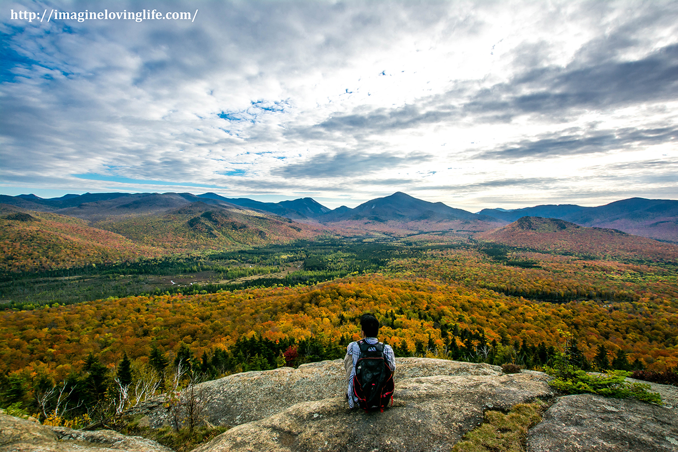
Mount Van Hoevenberg Hiking Guide Important Information
Trail Map: Trail Map 1, Trail Map 2
Difficulty: Moderate
Distance: ~4.4 Miles
Elevation Gained: 701 feet
Trail Breakdown
2.2 Miles To The Summit
2.2 Miles Back Down
Link: http://www.mapmyhike.com/workout/1207218171
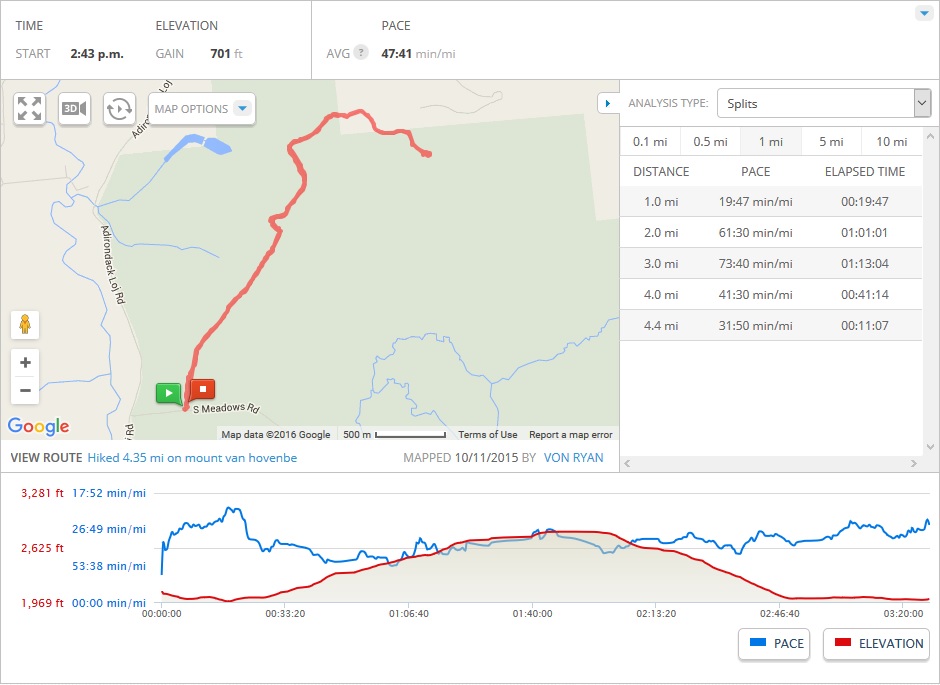
Note: The information is just an approximation.
Parking
[put_wpgm id=8]
Start Of The Journey
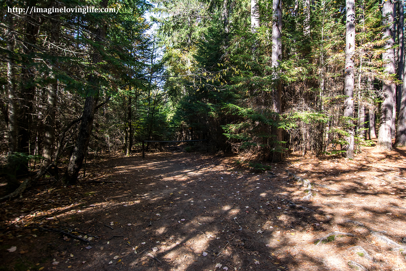
I knew from the … Read More....
Mount Flume, Mount Liberty And The Flume Slide Trail

Mount Flume, Flume Slide Trail and Mount Liberty Hiking Guide Important Information
Trail Map: Trail Map 1, Trail Map 2
Difficulty: Strenuous
Distance: ~10 Miles
Mount Flume Height: 4,328 foot
Trail Breakdown
Flume Visitor Center To Flume Slide Trail – 1.5 miles
Flume Slide Trail – 3.3 miles
Mount Flume To Mount Liberty – 1.2
Mount Liberty To Fork … Read More....
Mount Washington Hike In New Hampshire
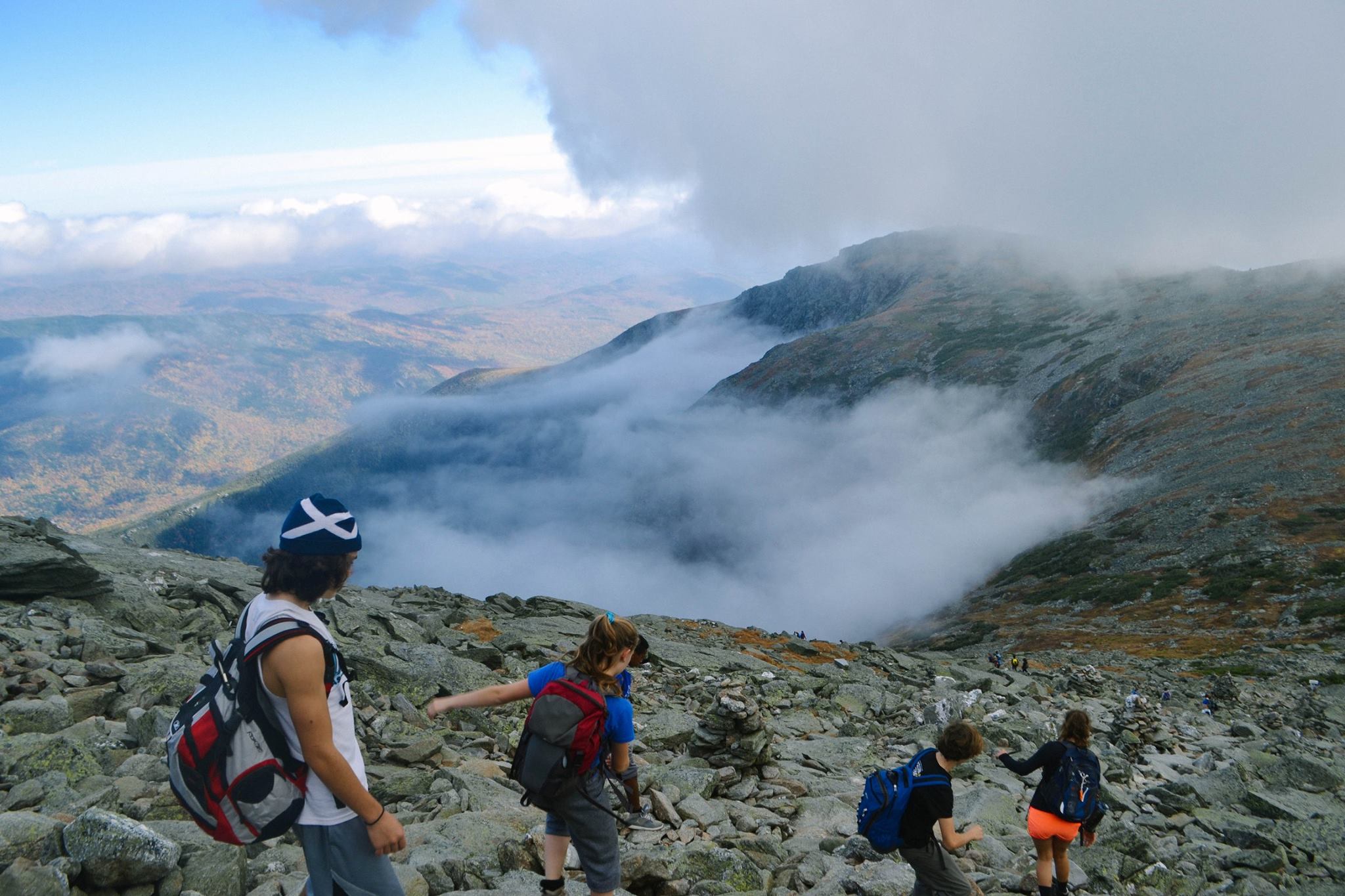
Mount Washington Guide Important Information
Trail Maps – Trail Map 1, Trail Map 2
Difficulty: Strenuous due to length and elevation gain
Distance: ~9 Miles
Elevation Gain: 4210 ft
Trail Breakdown
Tuckerman Ravine Trail – ~2.3
Lion’s Head Trail – ~1.4
Tuckerman Ravine Trail To Summit – ~0.6
Length – Approximately 4.3 miles one way going up
Link: http://www.mapmyhike.com/workout/753240411… Read More....
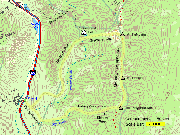
Franconia Ridge Hike
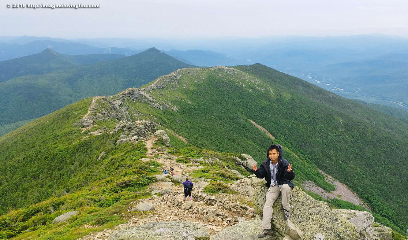
Franconia Ridge Guide Important Information
Trail Map: Trail Map 1, Trail Map 2
Difficulty: Strenuous due to length and elevation gain
Distance: ~10 Miles
Elevation Gain: 3390 ft
Trail Breakdown
Falling Waters Trail – ~3.2 miles
Franconia Ridge Trail (AT) – ~1.7 miles
Green Leaf Trail – ~1 miles
Old Bridle Path – ~3 miles
Duration – Took Us … Read More....