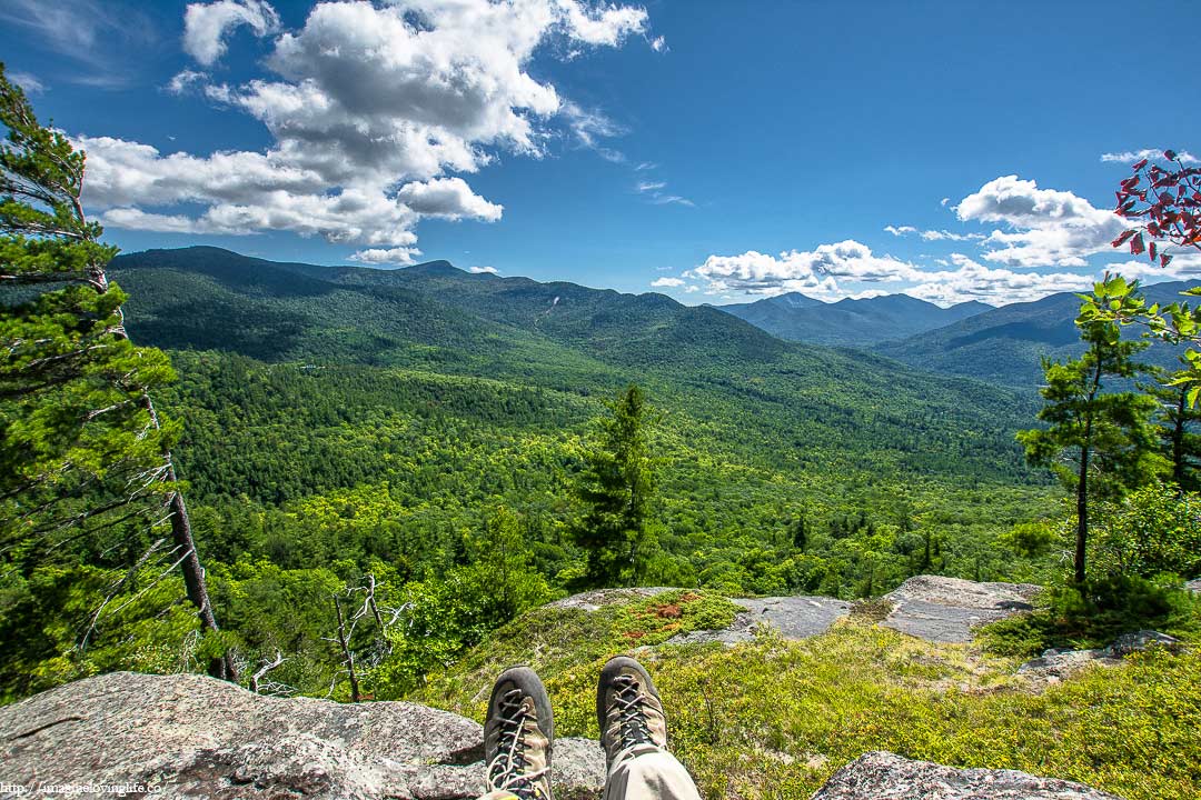
Baxter mountain hike has amazing views and it is very easy also. You can go in then get out as quickly as possible. It doesn’t take a lot of time to get to the viewpoint so it is good for families, tourists and hikers of all fitness level. I just love hikes that offer amazing views with very little effort.
Baxter Mountain Important Information
Trail Map: Trail Map 1
Suggested Phone GPS Apps: Alltrails.com, Avenza Maps, Google Maps
Difficulty: Easy
Distance: 2.5 Miles
Elevation Gained: 800 ft
Portable Toilet At Parking: None
Trail Breakdown
1.25 Miles Blue Trail Going Up
1.25 Miles Blue Trail Going Down
Note: The information is just an approximation.
Parking
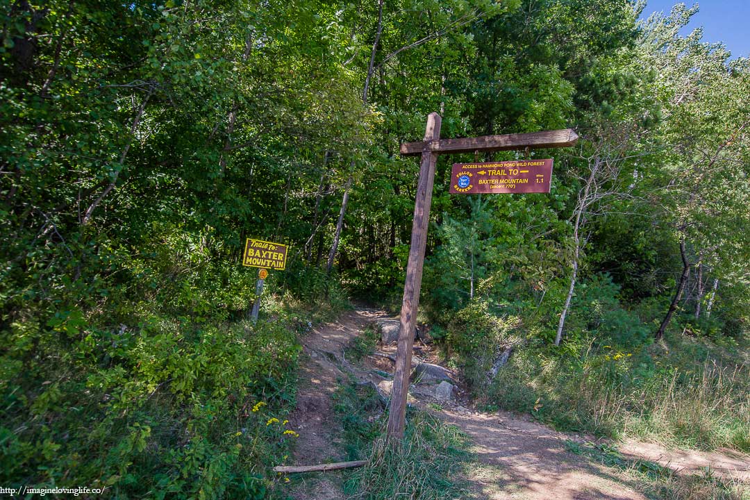
Start Of The Hike

It was a short hike that I wasn’t even planning on doing. I got lost and when I parked my car to the side to look at the GPS, the trail head spun the curiosity and intrigued inside of me. It seemed like a quick hike according to the map so I decided to try it out. Sometimes fate lends you a hand, and sometimes it kicks you in the butt too but for today, fate was nice and kind.
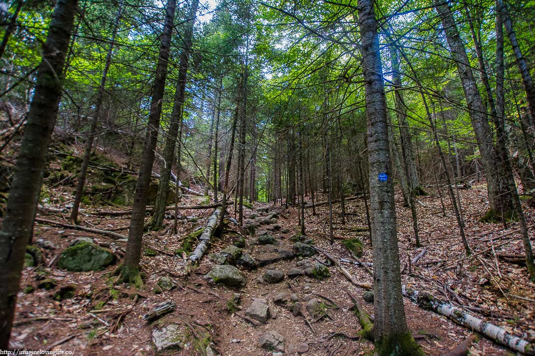
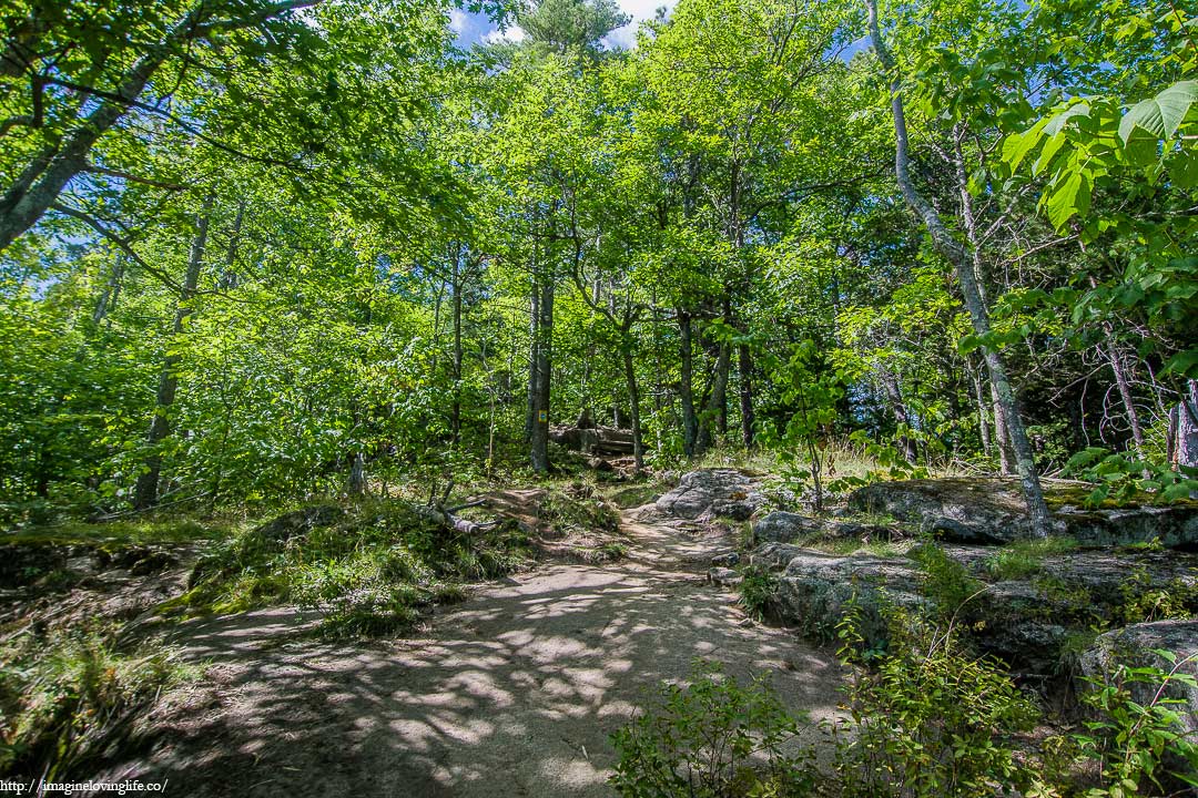
Baxter Trail
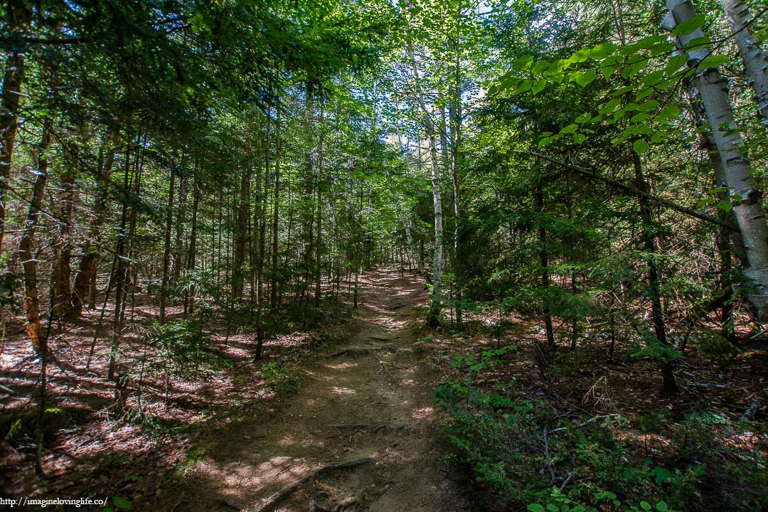
Baxter Trail Going Up
The footpath was an ascent going to the viewpoint filled with various rocks and boulders of different sizes. Dead trees and logs were scattered at the sides of the footpath, perhaps they were trimming down the forest or maybe they were also creating new trails. I stepped upwards, trying not to think too much and just enjoy the hike that I accidentally found myself in.
Baxter Trail
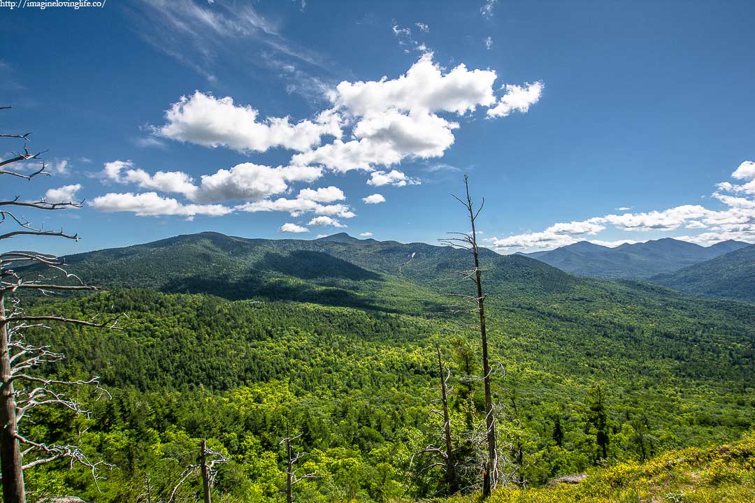
First Viewpoint
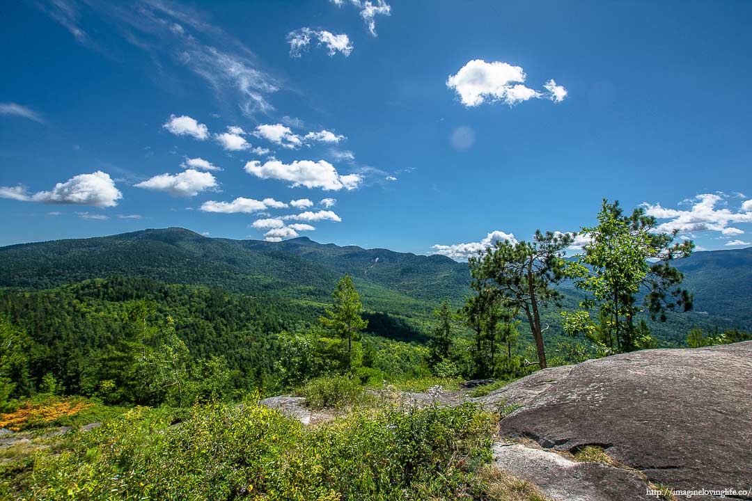
First Lookout
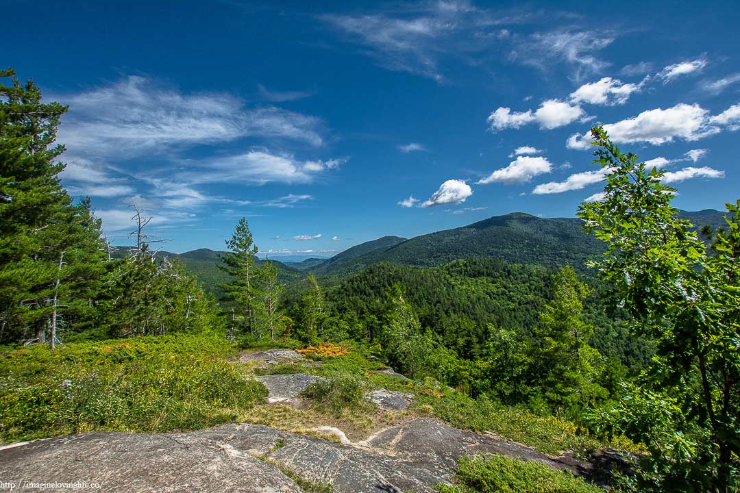
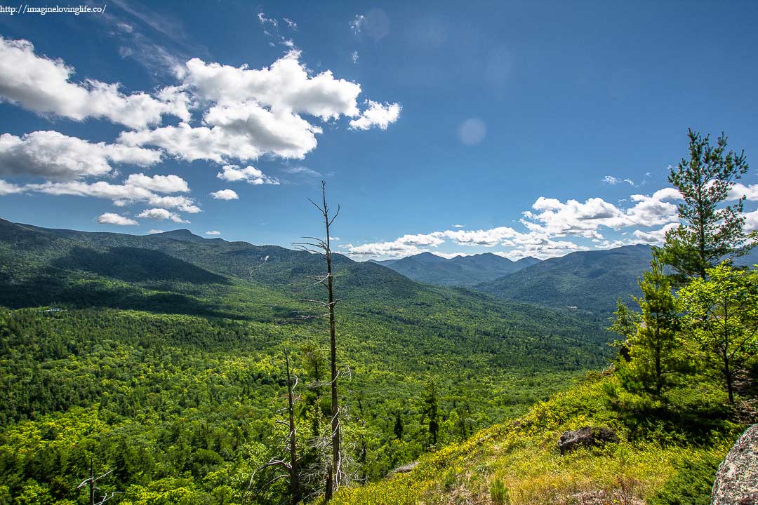
Second Viewpoint
Lookout
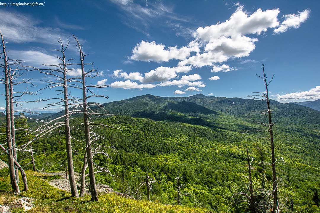
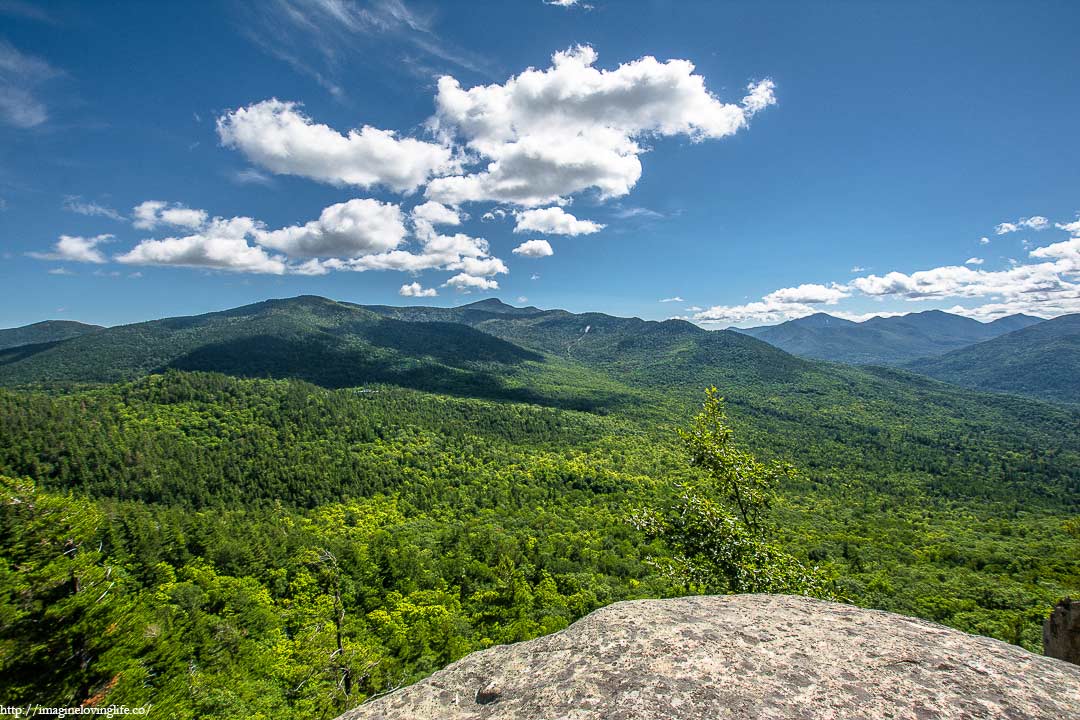
Different Angle
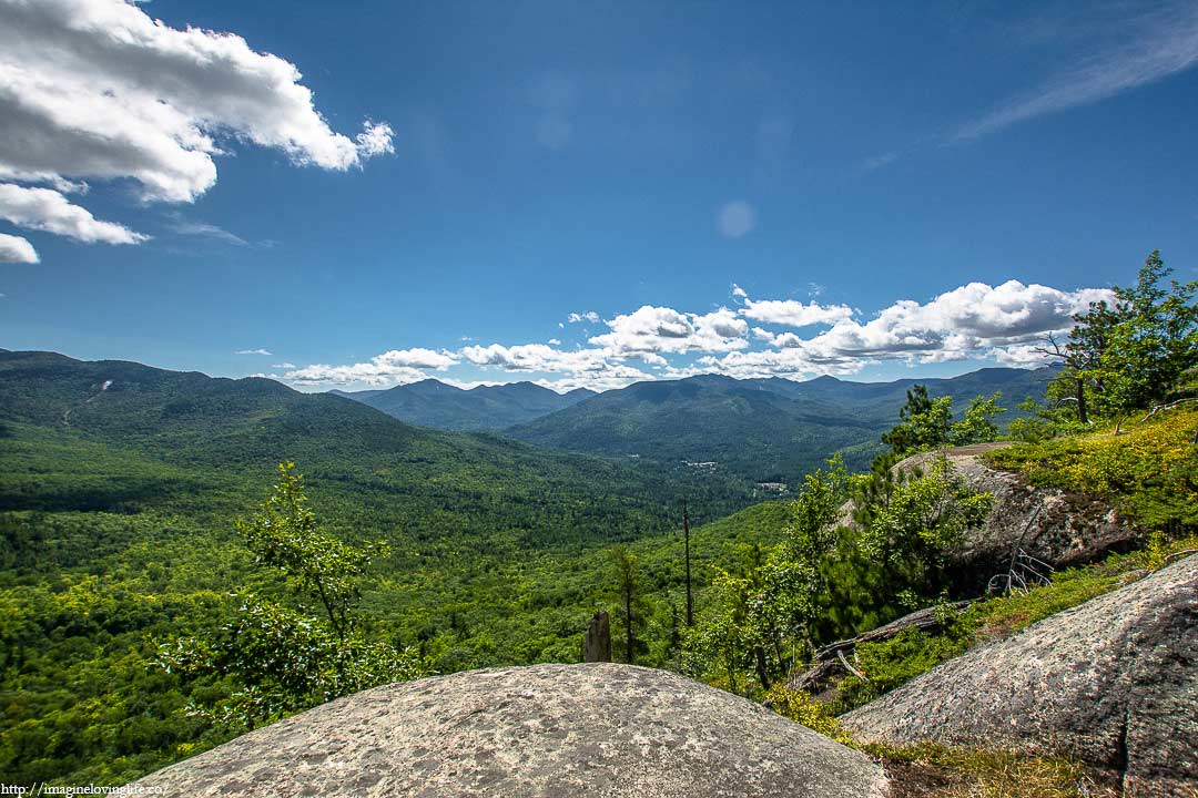
Further Down Was A Ledge
More Views
End Of The Hike